FORESEE
Use remote sensing data to develop forest-resource management tools suitable for use on individual parcels. Output includes qualitative and quantitative data on the available forest resources, harvesting conditions, and costs for energy applications.
CHALLENGES
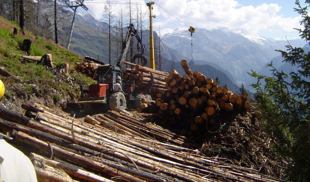
Increasing demand for wood-energy is putting pressure on the forestry industry to come up with more effective approaches to forest resource management. And, since you can’t manage what you can’t measure, the Foresee (Forest Resource Estimation for Energy) project aims to provide a more detailed, operationally-relevant picture of forest resources than what is currently available in France. And the most appropriate scale for forest-resource management data is the individual parcel. Project coordinator FCBA brought in top academic researchers in the field of remote sensing applied to forest resource management to help develop software and methods based in particular on LIDAR (Light Detection and Ranging) technology. This technology, when combined with forestry science, can produce data compatible with GIS (Geographic Information System) software, making forest resource management at the parcel scale—where data is directly actionable—a reality. LIDAR technology can also be used to generate detailed— with accuracy to within around 10 centimeters—digital models of forest terrain. These models are useful for operational tasks like locating roads on steep inclines and determining which harvesting techniques are most compatible with the terrain. GIS software can then be used to plan and streamline field operations from a forest-resource management office.
RESULTS:
Immediately-actionable forest-resource data at parcel level. The Foresee project has created a solid foundation for concrete applications for remote sensing and, in particular, LIDAR laser scanning data. The data produced using remote technologies is at least as good as field-survey data for certain forest-resource management indicators, like height. For other indicators, like volume and ground surface area, the results are similar or inferior to field-survey data. Additional development will be required to reduce the margin of error of these data. Above all, the project demonstrated that data captured using remote sensing methods can be of immediate use to stakeholders from both the public and private sectors across the entire forestry industry (parcel owners and managers, forestry cooperatives and other operators, forestry-industry businesses, local communities located in forested areas, and government agencies responsible for forest-resource management issues). The project confirmed that having detailed information at the parcel level does indeed align with these stakeholders’ operational needs.
GROWTH
The Foresee project made a significant contribution to France’s scientific literature on measuring forest resources. The results obtained on homogeneous stands in France are similar to or better than those obtained in other countries. The results are also promising for mixed and hardwood stands. The final project deliverable was a map of a 1,200 sq. km area of forest in France’s Vosges mountains. Field-survey data were used to compare software and validate the methods developed during the project. Foresee provided the cornerstone for the future commercialization of data-driven forest-resource management solutions. Such solutions are already available in other countries, where the dominant business model is based on partnerships between research organizations and businesses.
OUTLOOK
The use of remote sensing methods is becoming increasingly common. And more readily available remote sensing data will drive the adoption of the software and methods developed under the Foresee project. LIDAR data is already used by the French government for land-use planning purposes and, thanks to Foresee, LIDAR could now also be used to gather forestry data. The software and methods developed under the project could be scaled up for commercial distribution by partners like Sintegra, the surveying company that pioneered LIDAR in France. Sintegra has already expressed an interest in adapting the project deliverables so that they could be sold as part of a forest resource data service targeting Sintegra’s customers, mainly government agencies and developers.
Financing
ANR (the French National Research Agency).
Project consortium